🇺🇸🇨🇦 Travel Logs v2025.09: 5 cities
Table of Contents
Originally written in Chinese and translated into English using Sonnet 4.5
The day after my internship ended, I set off to explore Eastern Canada.
Halifax and St. John’s were essentially Britain’s two most important cities in Canada before they took over French territories in 1763—one a military stronghold, the other a fishing hub.
Before diving in, a quick history refresher is necessary: The Seven Years’ War (1756-1763), known in North America as the “French and Indian War,” was essentially the decisive battle between the British and French empires for North American dominance. During the war, British forces not only conquered French Canada but also secured important victories in India and the Caribbean. The Treaty of Paris, signed February 10, 1763, formally ended the conflict—France ceded all North American territory east of the Mississippi River (except New Orleans) to Britain, while Spain handed Florida to Britain in exchange for Cuba.
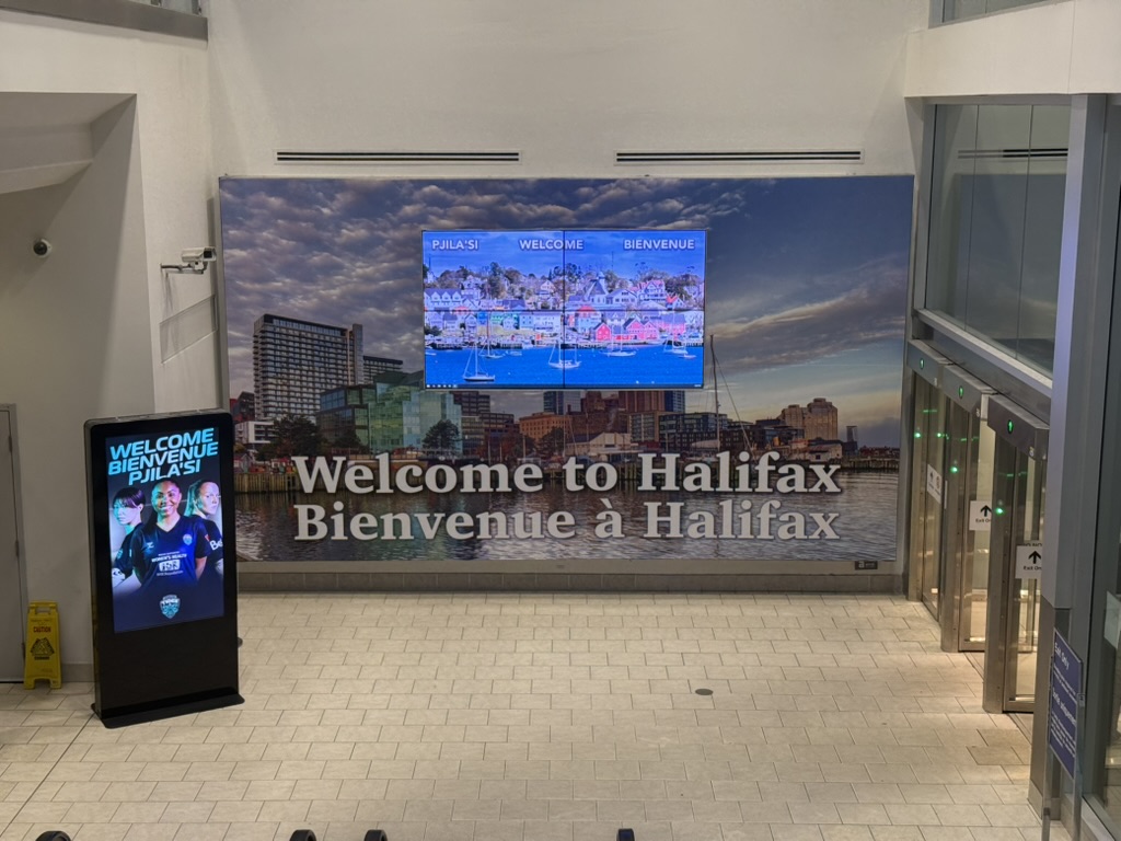
🇨🇦 Halifax
Halifax is the capital of Nova Scotia. The name itself is quite interesting—it’s Latin for “New Scotland.” This land was originally home to the Mi’kmaq indigenous people, who called it Mi’kma’ki. The French arrived and named it Acadia , until 1621 when the Scottish king granted the territory to Scottish poet and explorer Sir William Alexander. This highly literary gentleman chose to commemorate his monarch by naming the land Nova Scotia in Latin. Although Scotland’s colonial attempt lasted only three years from 1629-1632 before failing, this literary Latin name endured.
After leaving the airport, I took the hourly bus to the hostel in the city center. This was my first time staying in a North American hostel, and I discovered they generally don’t provide locks. So I bought one at the front desk for $6.

Canada’s Atlantic provinces have long faced labor outflow issues, and Halifax is no exception. Like most immigrant cities, today’s Halifax is hard to characterize as a particularly distinctive tourist destination.
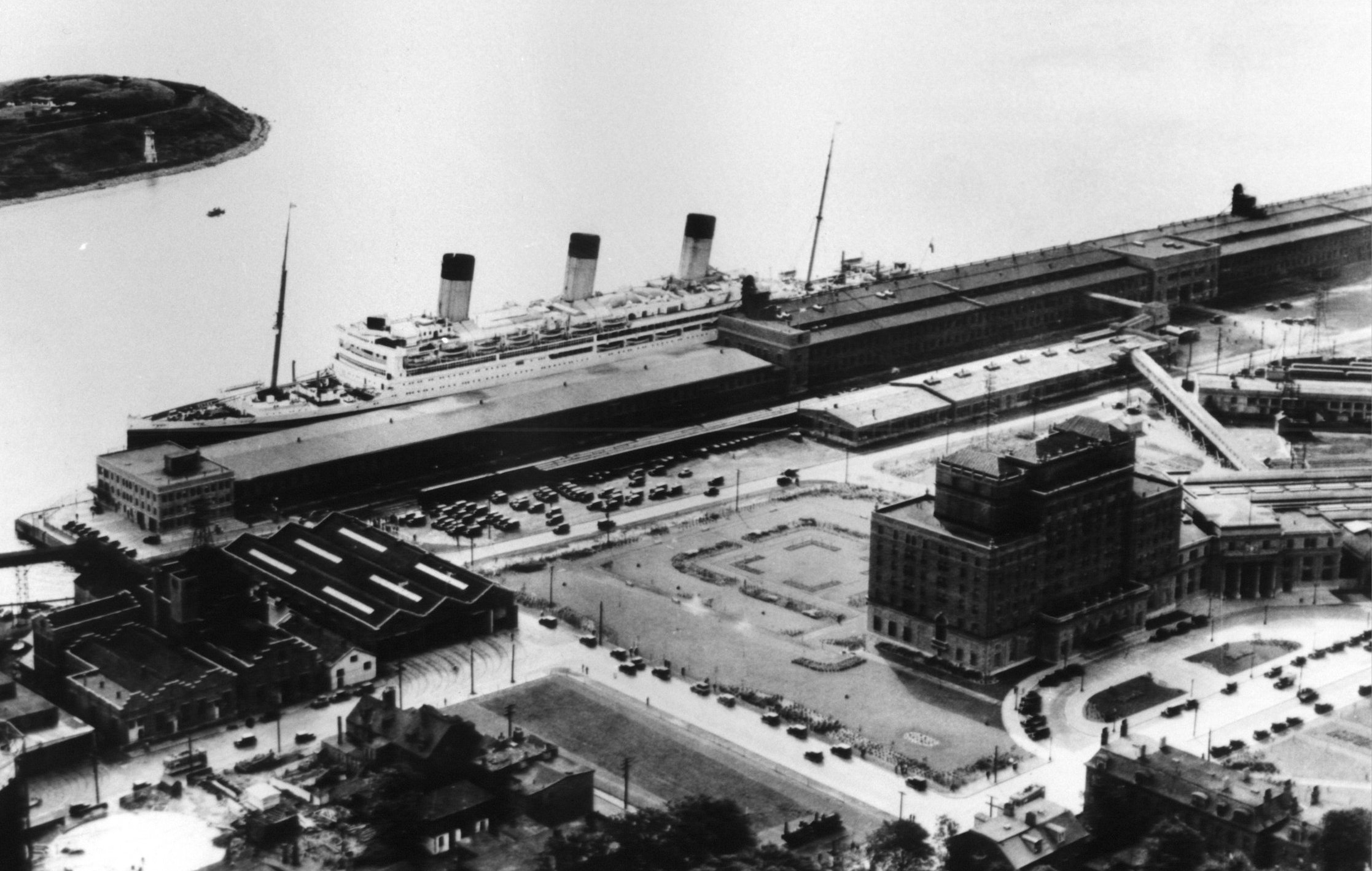
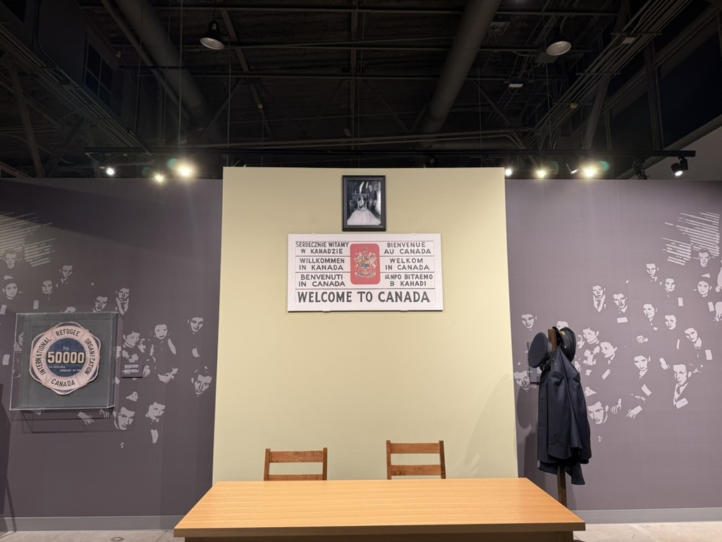
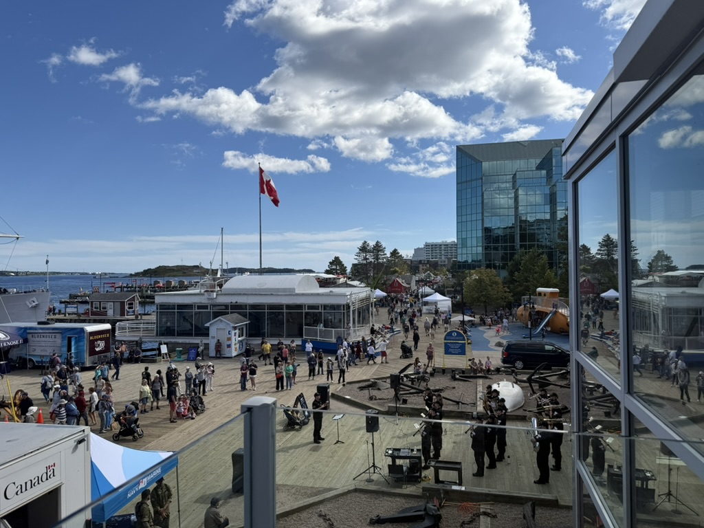
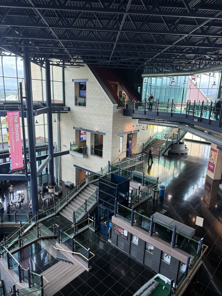
However, historically this was once Canada’s busiest port city, especially after WWII. As a major landing point for European immigrants, Halifax’s Pier 21 received millions of immigrants. An immigration processing office building next to the port has been converted into the Canadian Museum of Immigration , preserving the waiting halls, archives, and extensive immigration story exhibitions from that era. New immigrants went through a series of procedures here until finally learning whether they could stay as residents. Apparently one in five Canadians today has a direct or indirect connection to this port.
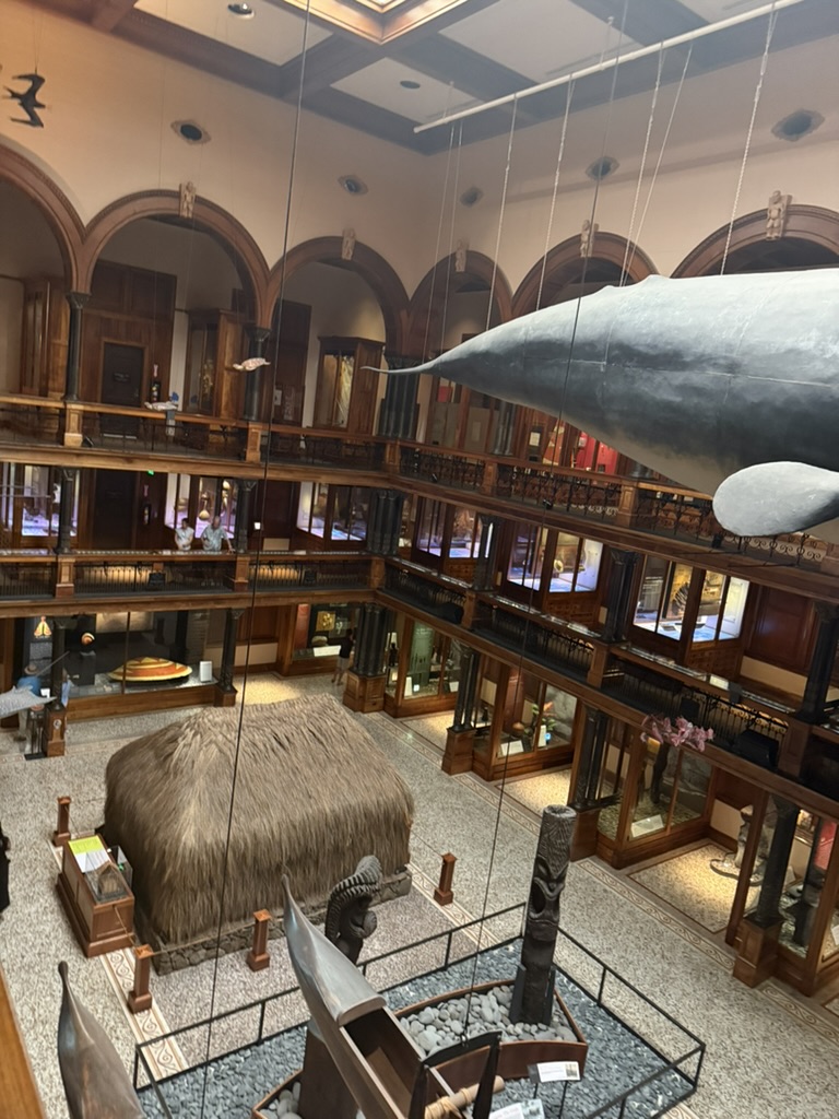
Next, I visited the Maritime Museum of the Atlantic. Most Eastern Canadian cities are deeply connected to North Atlantic maritime history during WWI and WWII.
After the Titanic disaster, Halifax was the only major port nearby. The main rescue teams departed from here, and over a hundred unclaimed bodies were buried here. The museum documents some of the stories from that time.
It also records the 1917 Halifax Explosion—during WWI, the French ammunition ship Mont-Blanc collided with the Norwegian relief ship Imo due to a series of geographical and human factors, triggering the largest non-nuclear explosion in human history to date. The blast killed about 2,000 people and injured 9,000. Nearly every family was affected, making it an important part of local collective memory.
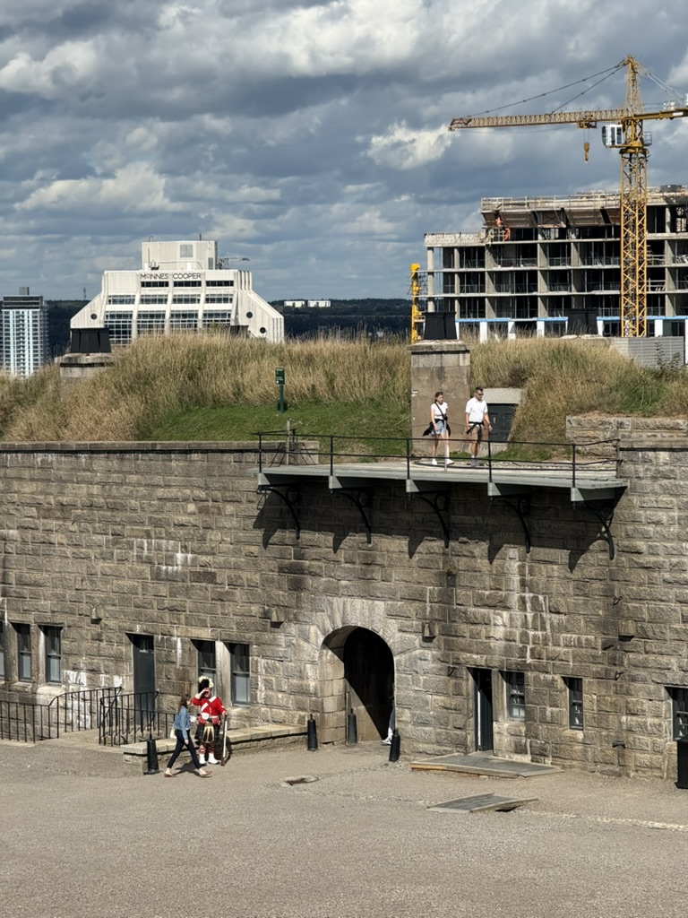
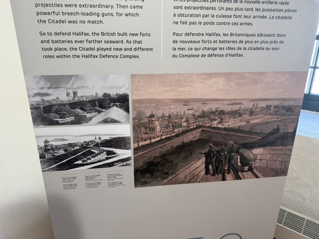
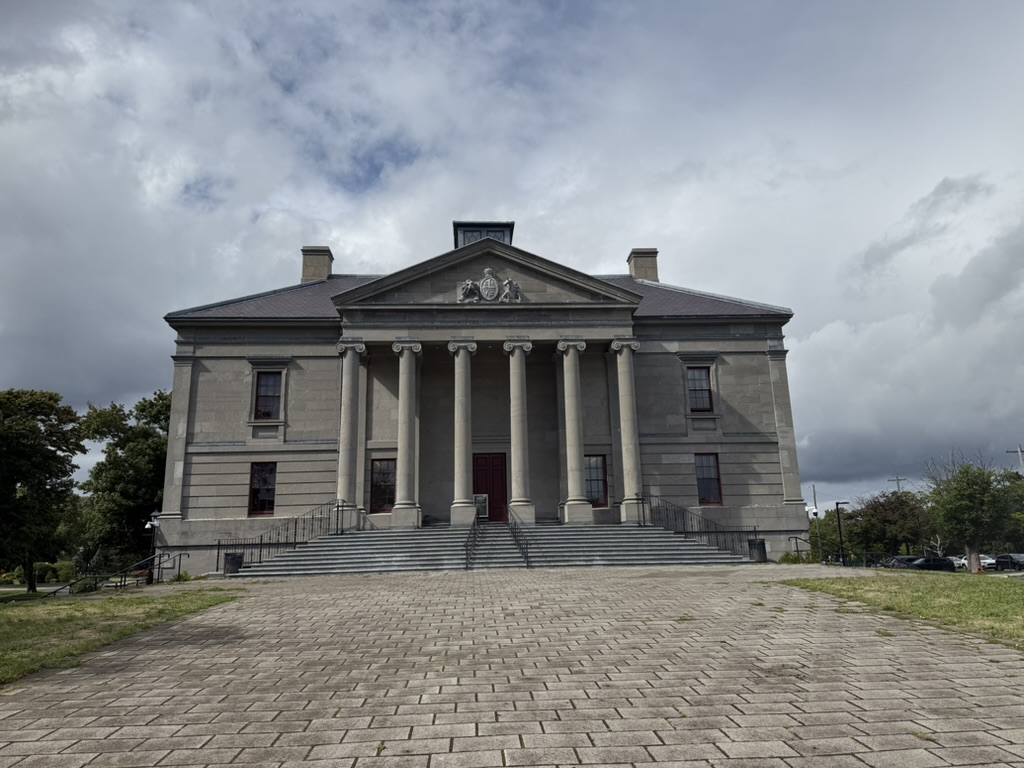
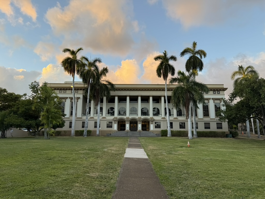
The next day I visited a star-shaped fortress built by the British on the highland in the city center, with hourly reenactments of period changing-of-the-guard ceremonies. Inside the castle, besides information about the fortress itself, there’s an Army Museum telling WWI stories with incredibly rich content and exhibits describing the composition and strength of the Canadian Army at the time, battles, and more.
🇨🇦 St. John’s
I only stayed two days in Halifax before heading to St. John’s—the easternmost and oldest city in all of North America, and my original travel destination.
Compared to Halifax, St. John’s and the entire island of Newfoundland have a far more interesting history, giving me a distinctly different feeling from other North American cities.
The name Newfoundland comes from explorer John Cabot’s 1497 discovery and naming—literally “newly found land.” Although Vikings briefly settled here around 1000 AD (at the northernmost tip of Newfoundland, thatched Viking houses are preserved).
Interestingly, Newfoundland historically maintained a high degree of autonomy:
- 16th-17th centuries: One of Britain’s earliest overseas colonies, living off fishing
- 1825: Formally became a British Crown Colony
- 1907: Status elevated to “Dominion,” on par with Canada, Australia, and New Zealand at the time—all “quasi-independent nations” under the British Crown
- 1934: Due to financial collapse from the Great Depression, voluntarily relinquished dominion status (the only dominion in history to do so)
- 1949: Through referendum, voted by a narrow 52% majority to join Canada, becoming the tenth province
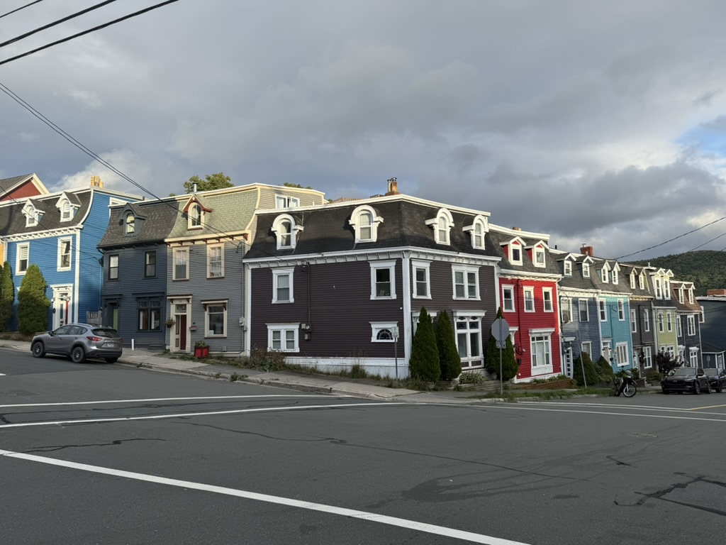
Historically, Newfoundland’s core industry was fishing until modern cod overfishing, which created the area’s unique harbor culture: fishing villages everywhere, colorful row houses, and seabird colonies. Combined with the unique Atlantic climate, it creates this “edge of the world” feeling—wind-beaten, sea-eroded, peripheral.
Since I didn’t have a car and taxis were expensive, I joined a small tour group led by a local Newfoundlander. Besides me and another woman from Bangladesh who just graduated in Toronto (also studying CS), the remaining four were all elderly ladies from Australia or other parts of Canada.
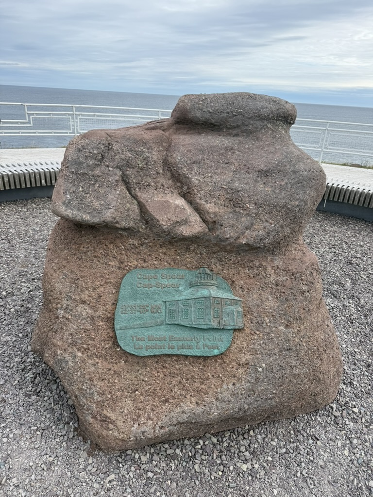
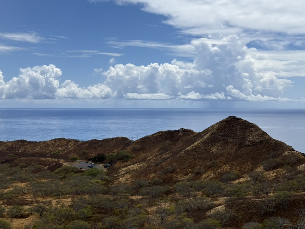
We went to Cape Spear, the easternmost point of the North American continent, which originally served as a lookout post monitoring the North Atlantic during WWI.
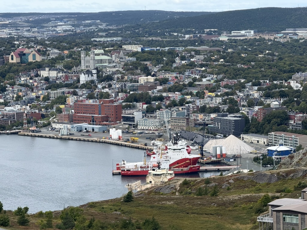
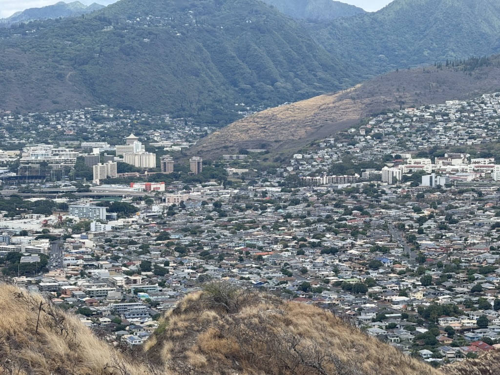
Then we headed to Signal Hill, where you can overlook the entire town of St. John’s. It’s called Signal Hill because this is where Marconi conducted the first transatlantic wireless transmission experiment in 1901 (though this is disputed). This experiment successfully received the Morse code letter “S” sent from Cornwall, England. The invention of wireless radio would have enormous impact on the Titanic rescue operation just over a decade later.
Due to low commercial development, the area has preserved many local specialty shops and restaurants. Besides trying the famous cod (a ban was imposed in 1992 due to overfishing, the cod population collapsed and hasn’t recovered to this day—what’s available now is all farmed), I also ate at highly-rated local Filipino and Ethiopian restaurants. Tasting food from around the world at North America’s eastern edge was quite an interesting experience.
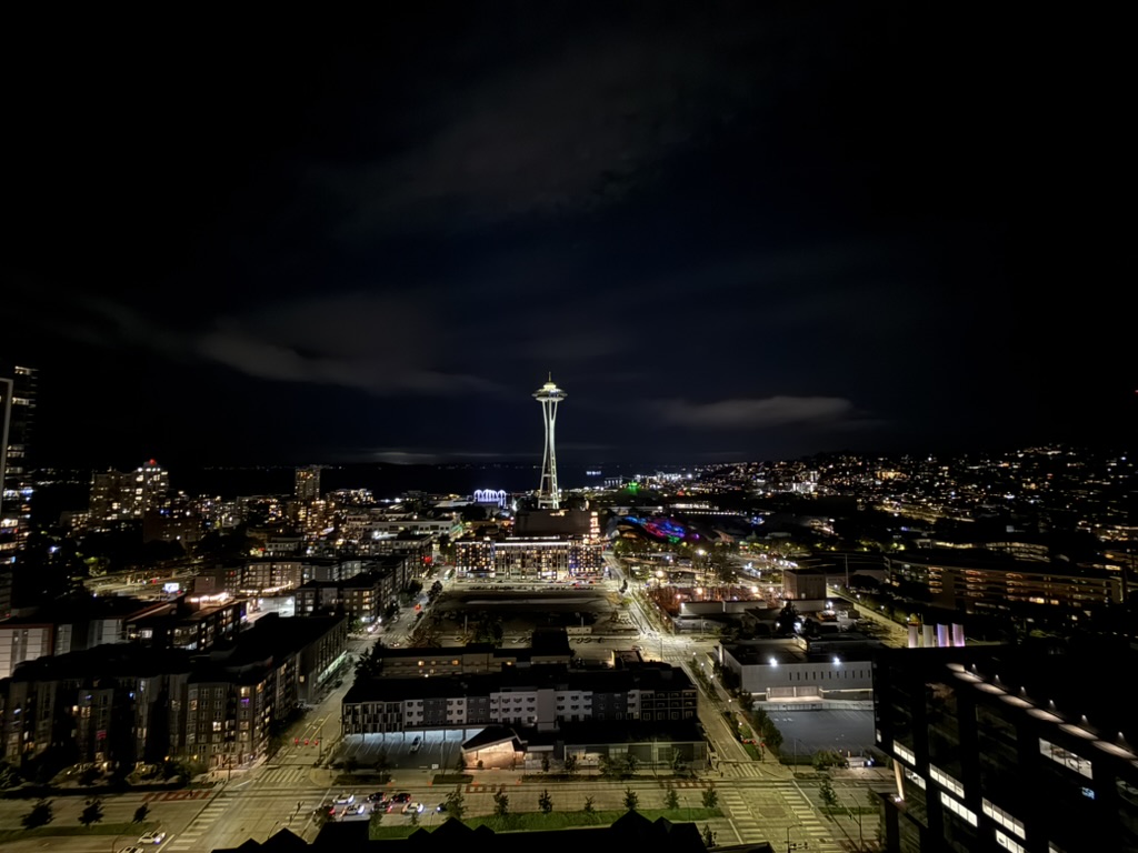
🇺🇸 Seattle
After returning to Vancouver from St. John’s for a day’s rest, I set off for Seattle.
When booking tickets, I checked flight prices—about 180 CAD (pretty normal and cheap). Even taking the train would cost about three hours and roughly 110 CAD, so all things considered, I chose to fly.
I’d never paid attention to ticket prices before, but researching this time I discovered that European flights of similar duration cost only 20-30% of North American prices. The reason is that Europe ultimately has many competing transportation companies, so prices are very low 🫠. Sigh, North America

I read on social media that Seattle’s public safety improved in 2024-2025, noticeably better than 2021-23. Some say it’s because Amazon’s RTO (return-to-office) policy forced them to improve safety 🤣. Those few Amazon buildings and the surrounding block are indeed very safe and clean, though other downtown areas still have the occasional unhinged or mentally unstable-looking person. I felt less safe than in Vancouver.

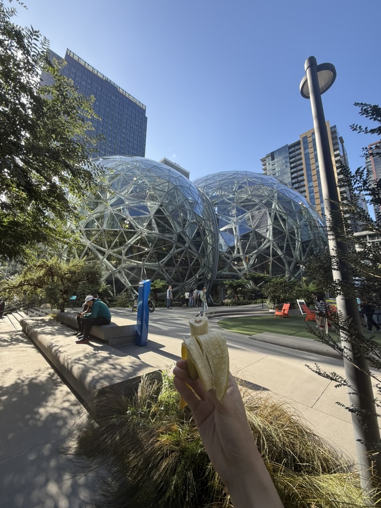
Seattle is more famous for its industry, pop culture, and tech sector—it’s both Boeing’s birthplace and home to Amazon and Microsoft headquarters. The city’s name “Seattle” comes from Chief Seattle, a respected local Native American leader.
Historically, the Great Fire of 1889 nearly burned down the entire downtown district. Although the disaster’s scale was massive, fortunately there were almost no casualties. After the fire, the city was replanned: streets were widened, buildings were generally changed to brick and stone construction, and more comprehensive sewage and electrical systems were established. Today, visitors can still find remnants of the old buried city in the downtown area, though I didn’t have time to see them.
Actually, many North American cities experienced similar disasters around the 19th century—Halifax’s harbor explosion, St. John’s 1892 fire, even Vancouver had a severe 1886 fire that razed the city (a magician I saw perform in Vancouver even mentioned this—quite interesting).
Though traumatic at the time, these events often became opportunities for urban reconstruction. It was precisely after these disasters that many cities had the chance to plan streets, infrastructure, and public services in more modern ways. You could say these accidents, to some extent, shaped the more orderly and convenient layout of today’s North American cities.
Also, Seattle rideshares are genuinely expensive—about 2-2.5 times Vancouver’s prices. Comparing them, Vancouver seems relatively cheap for labor among major cities (thanks to South Asian immigration).
Additionally, American museum admission isn’t cheap—almost all start at $30, while most Canadian museums are 10-20 CAD.
🇺🇸 Honolulu
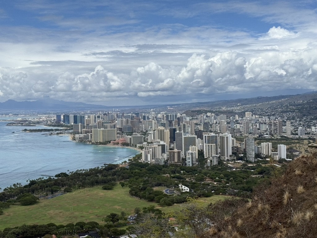
My initial impression of Honolulu came from reading “Dance Dance Dance” in high school, with its depiction of this “consumerist void”—but it was written so beautifully that for a long time I inexplicably longed for Waikiki. After arriving, I felt the consumerism aspect still falls far behind Tokyo 🤣
I visited the Big Island of Hawaii in 2022, and my first impression stepping off the plane this time was still the Pacific island’s unique “transparency”—exactly the same as three years ago. The sky and sea surface are so clear they almost lack depth, and what you see with the naked eye looks like a photo with a dehaze filter applied.
Honolulu is today Hawaii’s political and economic center, and also one of Japanese tourists’ most beloved overseas vacation destinations. This isn’t coincidental: from the late 19th to early 20th century, Hawaii attracted large numbers of Japanese immigrant laborers. By WWII, Japanese-Americans had become one of Hawaii’s largest ethnic groups. Because of this, Honolulu’s streets and communities retain a strong Japanese imprint.
Walking through downtown, you see Japanese-style architecture and restaurants everywhere. Many restaurants use ordering systems similar to Japanese fast food: counter ordering, quick service, no tipping required—relatively rare elsewhere in North America. The number of Japanese tourists and residents is also considerable. I’d say about three-quarters of Asian faces in Honolulu speak Japanese. Even ordinary residential buildings often evoke Japanese cities in their architectural appearance and community atmosphere.
You could say Honolulu is both a typical Pacific port city in cultural character and carries a unique Japanese stamp.
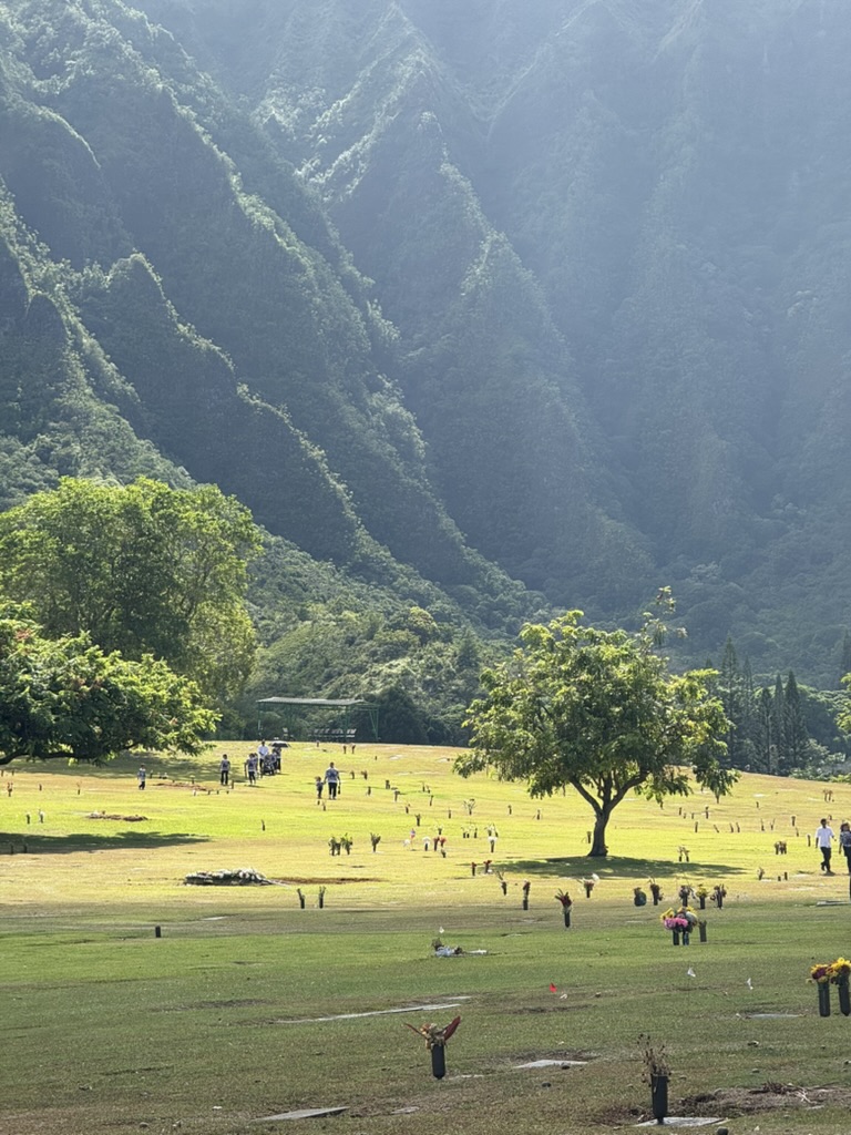
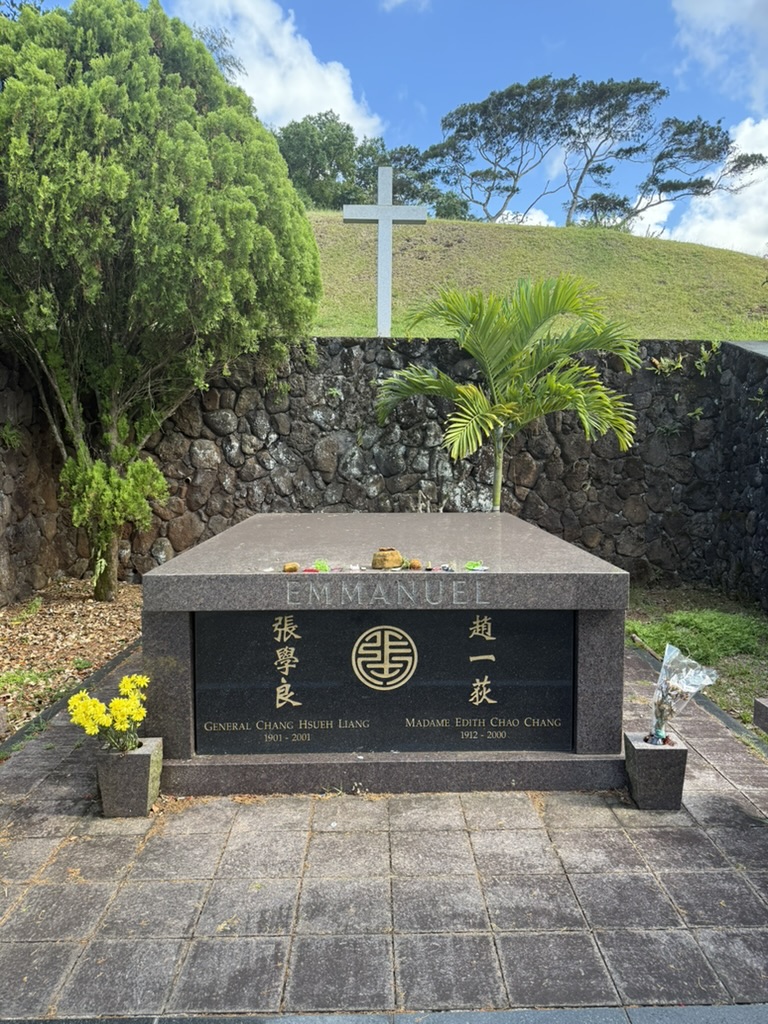
Taking half a day, I visited General Zhang Xueliang’s grave. He is buried with his wife Zhao Yidi at Nuuanu Memorial Park & Cemetery in Honolulu. The grave’s location was reportedly personally chosen by Zhao Yidi, situated high in the valley with a serene and open environment.
Surrounding it are rolling hills, seeming to pierce the clouds through the distant mist. The grandeur felt in person far exceeds what photos capture.
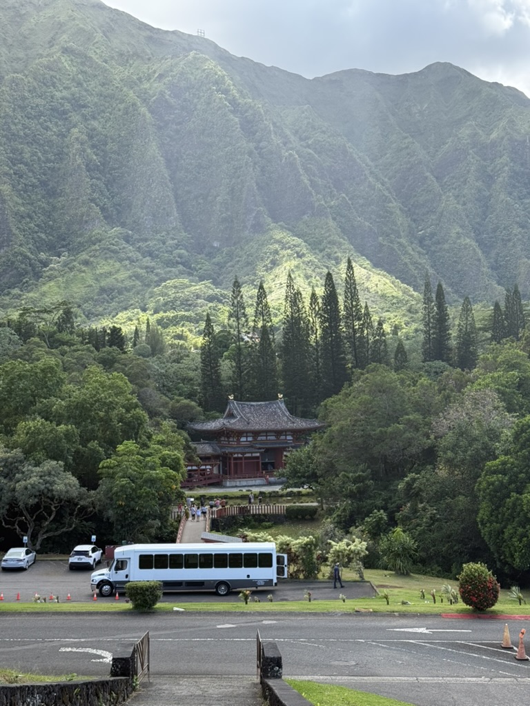
This Byodo-In Temple was built in 1968 to commemorate the centennial of Japanese immigration to Hawaii, modeled after the ancient temple in Uji, Kyoto. It symbolizes the profound influence of Japanese culture in Hawaii and is part of the local immigration history.
The feeling at the time was quite subtle: the cemetery symbolizes farewell and peace, while the temple not far away represents heritage and continuity. The two juxtaposed together—different cultures, different life trajectories—all converge and overlap on this Pacific land, continuing to flow through history’s long river.
🇺🇸 Point Roberts
On the evening of the last day of September, after dining with friends, we had a spontaneous idea to visit a place we’d long wanted to see but never managed to—Point Roberts. Back in July during my internship, I was already curious about this peculiar piece of land, but my friend couldn’t rent a car yet, I hadn’t learned to drive, and inconvenient transportation meant the plan was temporarily shelved.
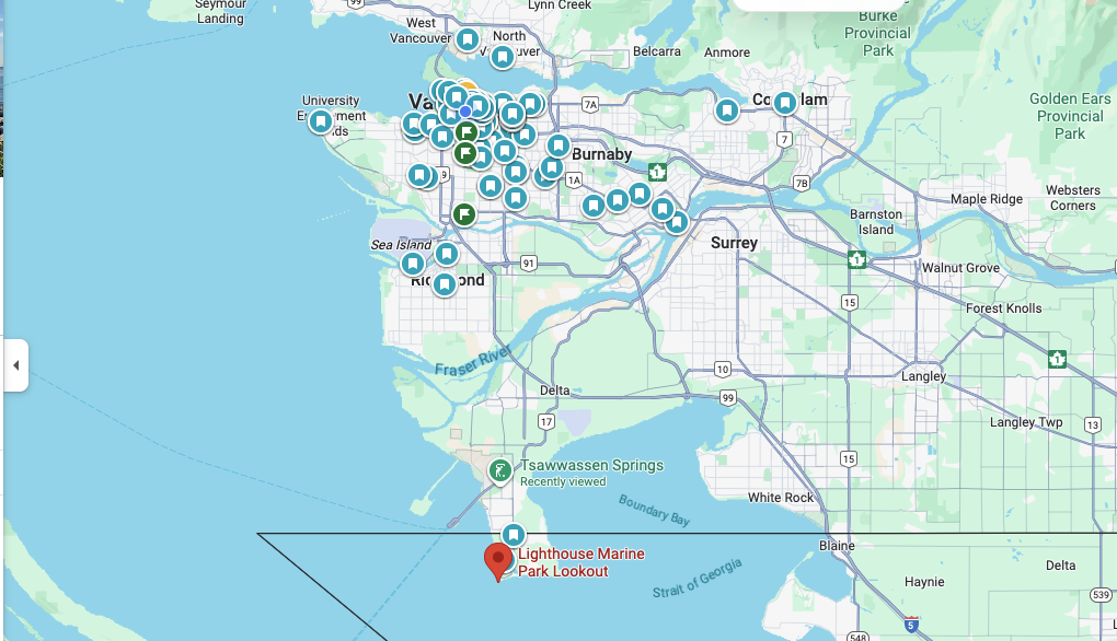
Point Roberts is both a geographical curiosity and a historical remnant. It belongs to Washington State, USA, yet is a piece of land completely separated from the American mainland. This territory sits at the southernmost tip of the Tsawwassen Peninsula south of Vancouver (an area that’s still highly autonomous indigenous land). Because the 19th-century British-American border was simply drawn along the 49th parallel, the peninsula’s tip ended up assigned to the United States. It has about 2,000 residents, similar to American suburban towns.
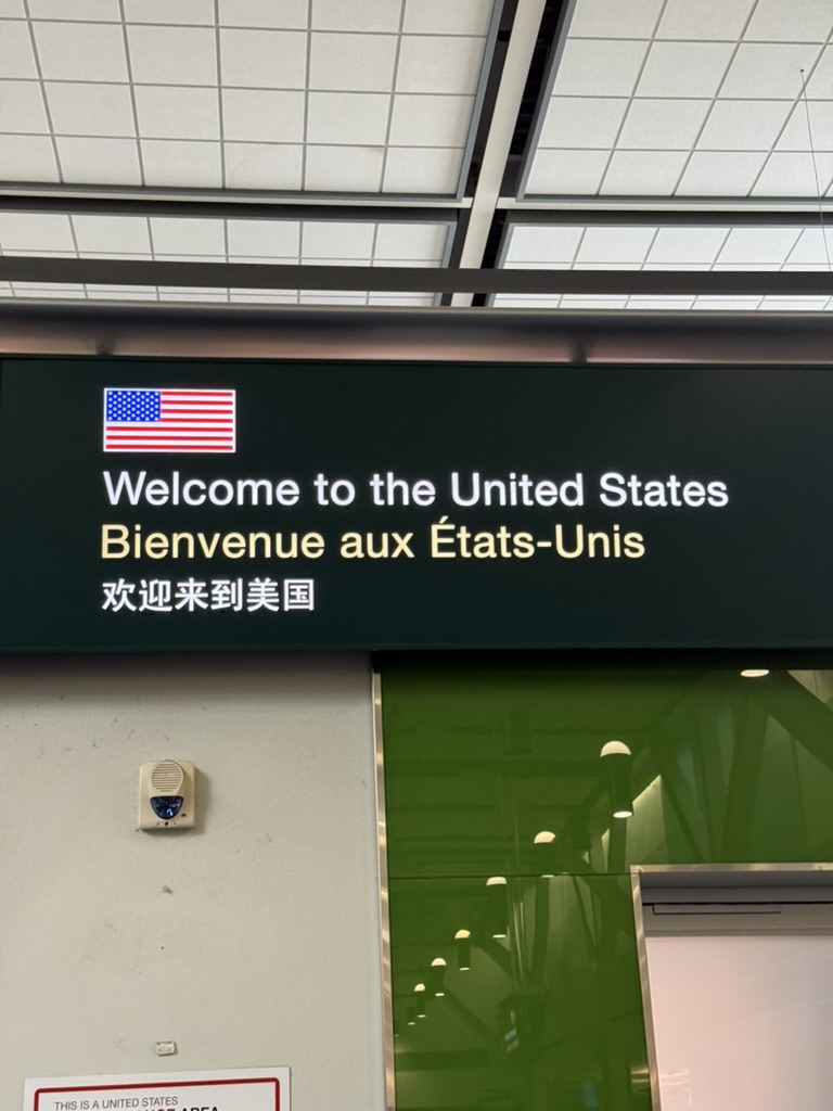
Therefore, whether local residents or visitors like us, traveling from the US mainland to Point Roberts requires first entering Canada, then reentering the United States—crossing the border twice.
We drove there late at night. Unclear about the process, we mistakenly thought we needed to get out of the car, which immediately drew a string of impatient complaints from the border officer. While checking our documents, he grumbled and questioned us “what the hell can you see sightseeing here in the middle of the night?"—fair point, honestly 😂, but he still let us through.
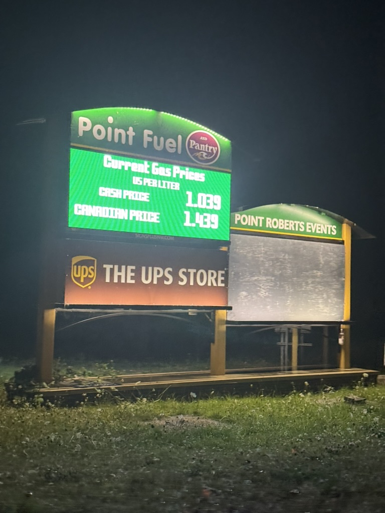
When leaving, reentering Canada, the Canadian border officer was noticeably much warmer and more courteous. The contrast was clear.